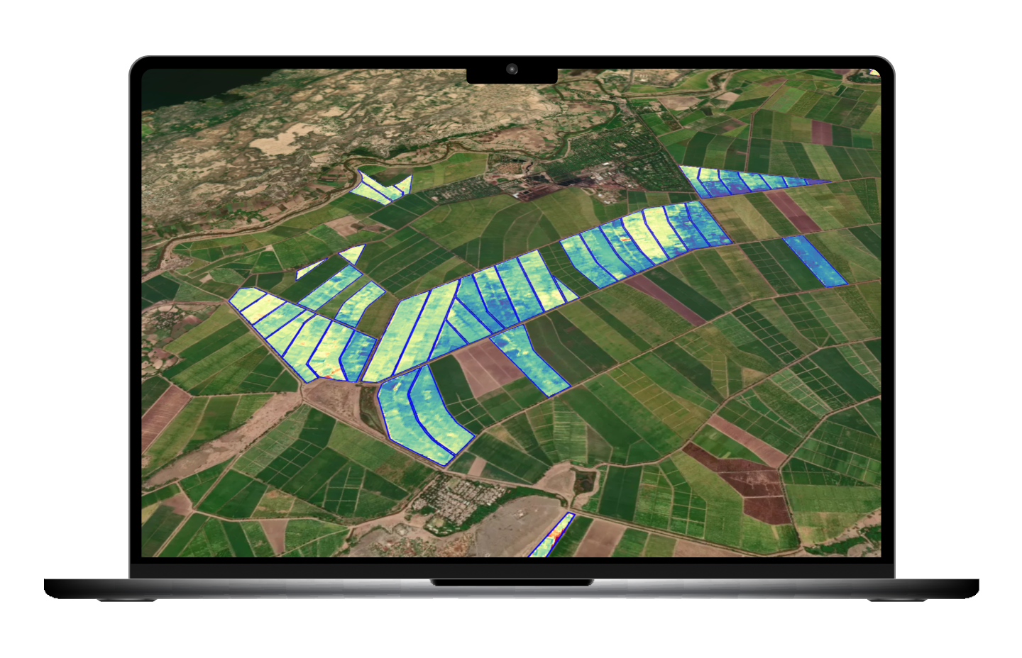
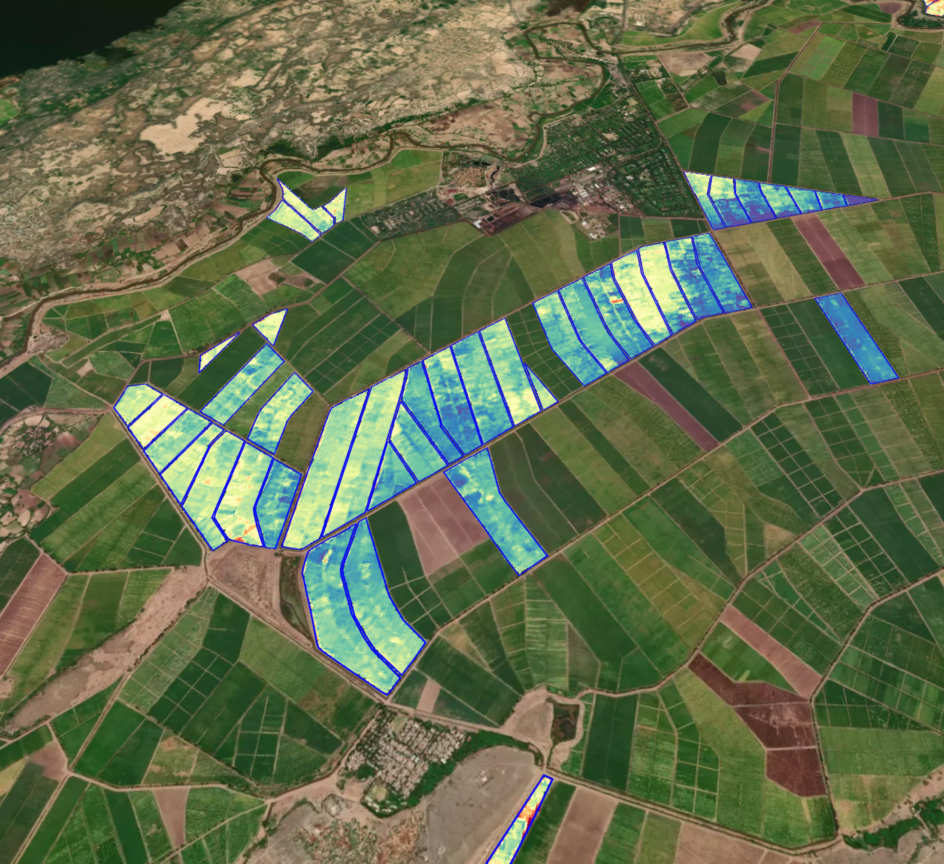
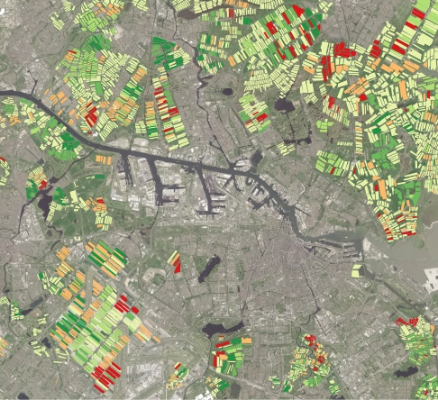
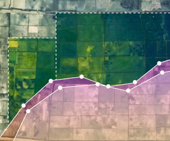
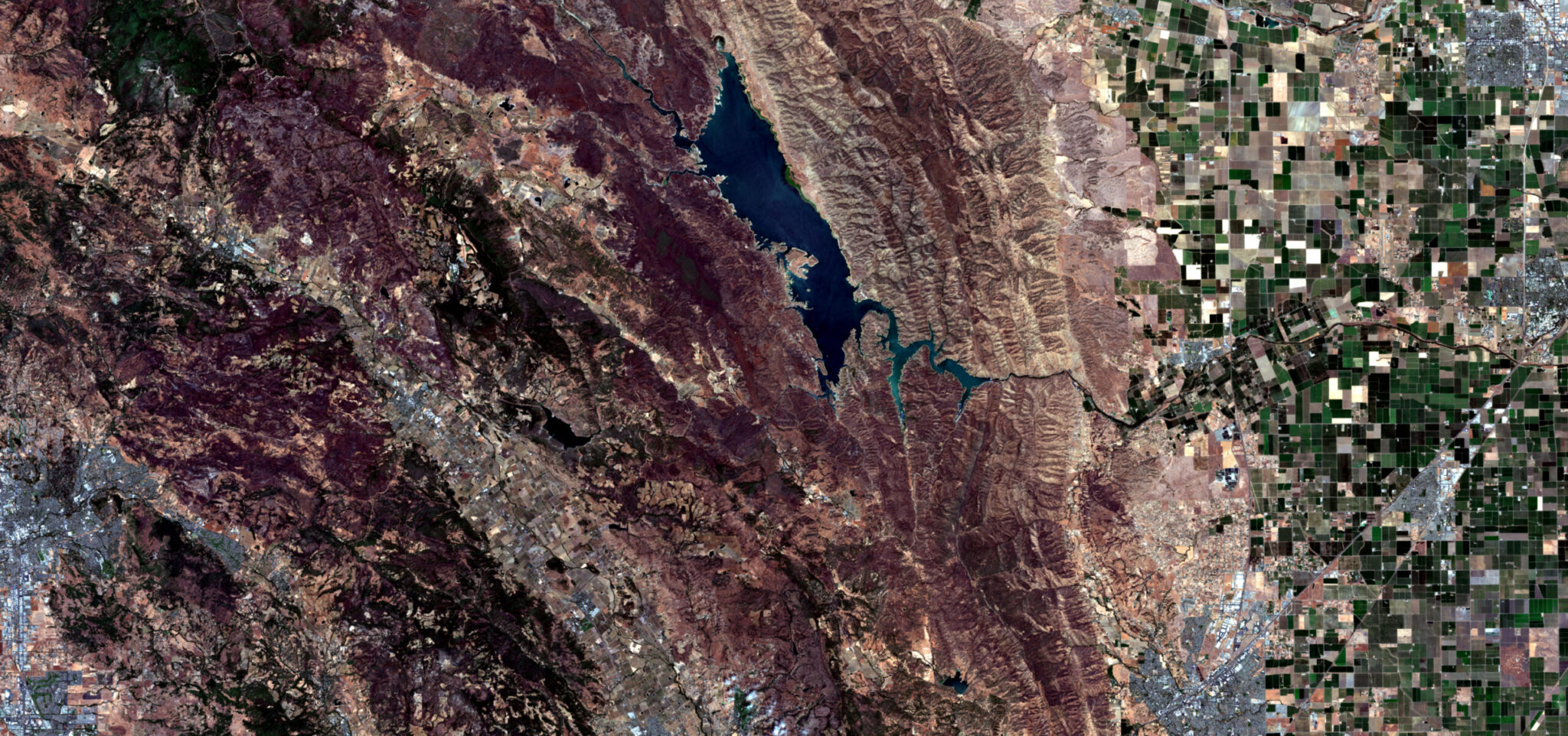
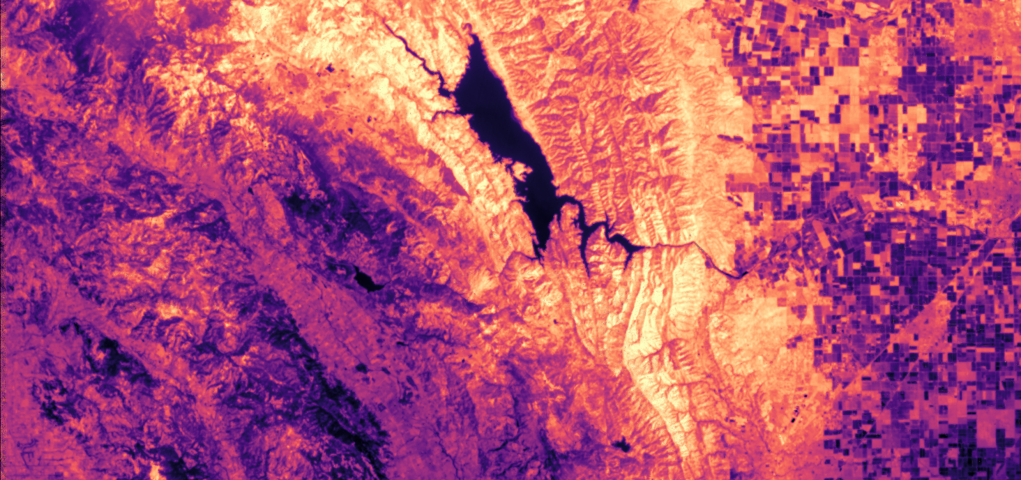
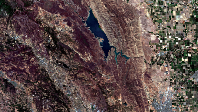
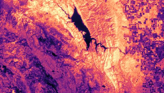
We're hiring! Join our team >>

High resolution thermal imagery: every day, everywhere.

Infrared enabled analytics for climate and agriculture.
Contains modified Copernicus Sentinel data 2021
ABOUT

Help earth manage its most valuable resource: water.

Hydrosat provides geospatial intelligence for food security, public safety, and the environment.

SOLUTIONS
Thermal imagery
Contains modified Copernicus Sentinel data 2021

Thermal Imagery

Daily, global, high-resolution thermal imagery.

continuous imaging

Our thermal and multispectral infrared imagery is collected and distributed on-demand to everyone who needs it.

High Resolution

A new benchmark for satellite thermal imagery to power focused applications.

Every day, Everywhere

No more long waits for the thermal imagery you need today.

ACCESS

Hydrosat API Delivery
STAC Compliant
Cloud Optimized GeoTIFFs

DATA

Land Surface Temperature
NDVI
Science Quality Calibration
Analysis Ready
Visible + Near-Infrared Context Imagery

Crop Yield Forecasting

Hydrosat helps accurately forecast crop yield by leveraging thermal data. Our yield maps and reports allow agribusiness, financial customers, and farmers to understand local crop conditions and supply.

ACCESS

Hydrosat API Delivery
Intuitive web dashboard

DATA

County-Level Crop Yield
Crop Type Land Cover
LST & NDVI for Vegetation
crop yield forecasting image

Irrigation Solutions

We will use our thermal imagery to create analytics solutions that help farmers reduce their water, energy, and labor, while significantly boosting crop production.

In support of expanding its irrigation solutions, Hydrosat has acquired IrriWatch, a company that offers the world’s most advanced irrigation management software. The IrriWatch product enables growers to optimize farming operations, improve crop yields, and increase profitability.
irrigation solutions image
use cases

Our thermal data significantly improves on existing visual data use cases; it also enables new ones.

Irrigation Optimization
Wildfire Prediction & Monitoring
Drought Prediction
Disease Vector Mapping
Ecosystem Monitoring
Land Cover Classification
Water Resource Management
Urban Heat Mapping
NEWS
JUNE 08, 2023 | SPACENEWS

Hydrosat Acquires IrriWatch

APR 25, 2023 | TECHCRUNCH

Hydrosat Closes $20M in New Funding

Mar 16, 2023 | Silicon Luxembourg

The Final Word: Feed The World With Thermal Imagery

MAR 02, 2023 | AUTHORITY MAGAZINE

Hydrosat: Helping to Create a Resilient Food Supply Chain

OCT 06, 2022 | ACCESSWIRE

Hydrosat Names Former Ceres Imaging Exec Brett Blom Vice President of Sales

AUG 09, 2022 | ACCESSWIRE

Hydrosat Recruits Bayer and Climate Corp Veteran as Head of Product

TEAM

Board of Directors

pieter fossel image

Pieter Fossel

CEO
LINKEDIN
royce dalby image

Royce Dalby

chairman
LINKEDIN
lori garver

Lori Garver

CEO of Earthrise Alliance
LINKEDIN
andy dearing image

Andy Dearing

President of Spatial STL Advisors
LINKEDIN
ryan johnson image

Ryan Johnson

President & CEO of Verge Agriculture
LINKEDIN
adam niewinski image

Adam Niewinski

Co-Founder & General Partner of OTB Ventures
LINKEDIN

Leadership

pieter fossel image

Pieter Fossel

CEO
LINKEDIN
scott soenen

Scott Soenen

CTO
LINKEDIN
Royce Dalby image

Royce Dalby

PRESIDENT
LINKEDIN
albert abelló

Dr. Albert Abelló

technical director
LINKEDIN
joshua fisher image

Dr. Joshua Fisher

Science Lead
LINKEDIN
rebecca mcginley

Rebecca McGinley

Director of Operations
LINKEDIN
boonyarit changaival image

Demir Devecigil

Head of product
LINKEDIN
boonyarit changaival image

Brett Blom

VP of Sales & Business Development
LINKEDIN